My Location - Track GPS & Maps
- 4.4
- Rating
- 10.00M
- Installs
- Free
- Price

 Analysis by App-foxy
If you need a simple way to mark where you are, send a location to someone, or keep a record of a journey, My Location - Track GPS & Maps is worth a look. I found it more focused than the large navigation apps I normally use. It is not trying to replace every map, traffic, or travel service on your phone. Instead, it puts the practical actions around your current position in one place.
That narrower purpose is also what makes the app easy to understand at first. You open it, look at your position, save a useful place, share a location, or begin tracking a route. The app comes from Andev and belongs to the Maps & Navigation category. It is free to install, rated for Everyone, and has built a substantial audience with a 4.4 average from around 69 thousand ratings and over 10 million installs.
My overall impression is positive, especially for people who often need to remember a parking spot, tell a friend where to meet, or preserve the path of a walk. The experience is less compelling if you want turn-by-turn driving guidance, live traffic, public transport planning, or a richly detailed travel platform. Understanding that distinction before installing it will save you from expecting the wrong kind of map app.
You May Also Like

 AccuWeather: Weather Radar
AccuWeather Review: A Quick, Clear Forecast for Everyday Decisions
For everyday plans, the best forecast is the one you can understand quickly. AccuWeather makes rain timing, radar, and local conditions easy to act on, with a few trade-offs.

 Hill Climb Racing
Why Hill Climb Racing Still Turns Crashes Into One More Run
A tiny car, a bumpy hill and one more upgrade: Hill Climb Racing keeps resurfacing because its simple chaos makes every near-miss feel personal.

 AliExpress - Shopping App
AliExpress Makes Global Shopping Feel Personal, but Shoppers Bear the Risk
AliExpress turns a global marketplace into a pocket-sized discovery engine. Its reach is useful, its shopping loop compelling, and its trade-offs easy to miss.

 Lords Mobile: Kingdom Wars
Lords Mobile Is a Kingdom-Building Routine, Not a Quick Match
A case-by-case verdict on the building, battles, device demands, and social commitments that make Lords Mobile rewarding for some players and exhausting for others.

 PDF Scanner app - TapScanner
TapScanner Makes Paperwork Easier to Capture, Check, and Share
TapScanner makes scanning with a phone feel less like a rescue operation and more like a dependable step in getting work done. Its capture tools are useful, though not flawless.

 Block Blast!
 Shows How Much a Puzzle Game Can Leave Out
A quiet grid game shows why puzzle players increasingly value instant clarity, repeatable skill and low-pressure play—and where the genre still needs to catch up.
More From Our News Desk
View All News


What to expect when you open it
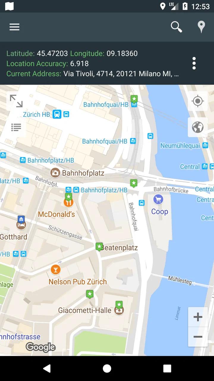
The first useful thing to know is that this is primarily a location utility rather than a full replacement for the biggest mapping services. I approached it as a small toolkit for handling my own position. That changed how I judged it: the important question was not whether it could do everything a major navigation platform does, but whether it made location sharing and route recording less awkward.
For that job, the layout feels approachable. A first-time user can think in four simple tasks: see where you are, save a point, share it, or track movement. Those tasks cover more everyday situations than the short store wording might suggest. A saved point can represent a car in a large parking area, a campsite, a meeting entrance, a trailhead, or the exact place where a delivery should be collected.
The app is strongest when location itself is the information you need. If you are explaining a place that is difficult to describe with a street address, a shared map position is often clearer than a long message. That is particularly useful at parks, beaches, event grounds, rural roads, and large campuses where several entrances may use similar addresses.
I also like the separation between saving a place and tracking a route. They solve different problems. Saving a place answers, “Where is that point?” Tracking answers, “Where did I go?” Keeping those uses distinct makes the app more practical than a simple pin-drop tool, while avoiding the clutter of a complete navigation suite.
The first setup should be treated as a quick test
After installation, I would not begin by planning a complicated trip. I would first open the map and check whether the displayed position makes sense. This is a small but valuable habit: stand somewhere you recognize, wait for the location indicator to settle, and compare it with your surroundings. That gives you confidence before you rely on the app in an unfamiliar place.
The current version is 3.129, and the app supports devices running Android 8.1 or later. On a compatible phone, the sensible setup path is simply to get the map visible, understand which control represents your current position, and then try one action at a time. I prefer this approach because it reduces the chance of starting a route recording accidentally or sharing the wrong point.
Location tools can feel confusing when a user expects the map to know their exact position instantly. In practice, the phone still needs a usable location signal, and the displayed point may take a moment to become more reliable. If the marker looks wrong, I would first move into a more open area and give it time rather than immediately assuming the saved place or route is faulty.
It is also worth deciding what you want to do before tapping around. If you are trying to remember a place, save it. If you are about to walk or drive and want a record of the journey, start tracking deliberately. If you only need to tell somebody where you are right now, use sharing rather than creating a route. This simple distinction is the key to a smooth first session.
Your first meaningful success: save a place you can find again
For a new user, I recommend making the first successful action a saved location. Choose a place with an obvious purpose, such as your parked car or the entrance to a building. Once the point is recorded, give it a name that will still make sense later. “North entrance” is more useful than “here,” especially if you save several locations during the same day.
Then move away from the spot and return to the saved point on the map. This small test teaches you more than simply pressing a button. You learn how the app represents a stored location, how much context the map provides, and whether your naming habit makes the list understandable. It also gives you a practical result you can use immediately instead of a feature demonstration with no real purpose.
A useful workflow is to save locations at the moment they matter, not after you have already left and are trying to reconstruct them from memory. At a festival, for example, I would mark the meeting point as soon as I arrived. At a trailhead, I would save the start before walking. At a shopping center, I would mark the parking area before entering. These are small actions, but they prevent the common problem of searching for a place later with incomplete clues.
Sharing is similarly more useful when you add context in your message. I would send the location together with a short explanation such as “meet beside the west gate” or “my car is near this marker.” The map point gives the recipient precision, while the note explains what they should look for when they arrive. A location alone is not always enough in a busy or spread-out area.
How route tracking fits into everyday use
Route tracking is best approached as a record of movement rather than a navigation promise. Before starting, I would make sure the intended activity is clear: a walk, a cycle, a drive, or another journey where the path itself may be useful afterward. Start the recording before moving, then stop it when the activity is genuinely finished. Doing this at the wrong moment can leave you with a route that includes the walk from your home, the time spent waiting, or an unrelated detour.
One realistic example is a weekend walk in an unfamiliar park. I could begin tracking at the trail entrance, follow the path without worrying about remembering every turn, and later use the recorded route to explain the walk to a friend. If I found a viewpoint or picnic area worth revisiting, I could save that point separately. The combination is more useful than either action alone: the route shows the journey, while the saved location identifies the highlight.
Another good use is checking a route after the fact. A recorded path can help you remember where you went, compare two walks, or show somebody the shape of a trip. I would not treat it as a substitute for a dedicated fitness application if detailed exercise analysis is your priority. The value here is the geographic record, not a promise of a complete training dashboard.
There is a trade-off with any tracking tool: the longer you leave it running, the more carefully you should manage when it starts and stops. A route that is meant to represent a hike becomes less useful if it includes an hour in a car beforehand. My practical advice is to create a start-and-finish routine. Open the app at the beginning, confirm that tracking is active, and stop it as soon as you reach the endpoint.
Common points of confusion before you rely on it
The most likely misunderstanding is expecting My Location to behave like a full turn-by-turn navigation service. I would choose a conventional navigation app when I need spoken driving instructions, traffic-aware route changes, public transport details, business discovery, or broad trip planning. This app makes more sense when I already know the journey or simply need to capture, save, and share geographic information.
A second confusion concerns the difference between a current position and a saved place. Your present marker changes as you move; a saved point is intended to remain associated with the place where you created it. If you save a location while standing beside a car and later walk away, the saved marker should be understood as the car’s position, not your new position. Keeping those concepts separate prevents a lot of unnecessary tapping and re-saving.
Sharing can also be misunderstood. Sending a location is useful for coordinating a meeting or identifying a place, but it is not the same as continuously reporting every movement. If your goal is for somebody to follow a journey live, you should choose a service designed specifically for ongoing location sharing. For a one-time meeting point or a fixed place, this app is much more appropriate.
Accuracy deserves realistic expectations as well. A map marker can be affected by the phone’s available signal and surroundings, particularly near tall buildings, dense tree cover, or indoor spaces. I would avoid saving a point while standing in a place where the phone is struggling to determine position. If the exact spot matters, wait until the marker is stable and check the nearby map context before confirming it.
Finally, remember that a route recording is only useful if you start it intentionally. I would make a quick visual check before setting off rather than assume the app has begun tracking because the map is open. That one-second pause is an important habit for anyone using the app for a walk, field visit, or drive they want to remember.
Three practical habits that make the app more valuable
My first tip is to use names as retrieval tools, not labels for the moment. Include a direction, entrance, level, or purpose when it helps. “Car, level two, east side” is far more useful later than a generic title. This matters when several saved places are close together or when you return after a long gap.
My second tip is to combine a saved point with a route whenever the destination is part of a journey. A route alone may show how you traveled but not clearly identify the place you cared about. A saved point alone may show the destination without preserving the approach. Using both creates a simple personal record for hikes, site visits, and days spent exploring.
My third tip is to share the location before the other person is already searching for you. Send the marker while you still have a clear view of the meeting point, then add a plain-language clue. This is especially helpful at large venues where a pin may land near several entrances. The recipient gets both the geographic reference and the human explanation.
A fourth habit is to test the workflow at home before using it during travel. Save a nearby place, share it with a trusted contact, and record a short route. This does not take long, but it removes uncertainty about which action you need when you are standing in a crowded station or unfamiliar neighborhood. First-time success is much more likely when the first real use is not also the first experiment.
Where it compares well, and where another app wins
Compared with a large general-purpose maps platform, this app feels less overloaded. That can be an advantage for someone who does not want restaurant listings, reviews, traffic layers, advertisements, or a long list of travel tools between them and their own location. The focused approach makes the basic workflow easier to remember: open, locate, save, share, or track.
The larger alternatives are better when the destination is unknown and the journey needs active guidance. They usually make more sense for finding businesses, checking road conditions, exploring public transport, or building a multi-stop itinerary. I would not abandon those tools for a long drive simply because this app handles saved points neatly.
On the other hand, a dedicated fitness tracker may be a better choice for runners and cyclists who care about training metrics, structured sessions, or detailed performance history. A specialized outdoor navigation product may be preferable for demanding trails and advanced route planning. My Location occupies a useful middle ground: more purposeful than a basic map pin, but less ambitious than a complete navigation or sports platform.
The free entry point makes it easy to try without committing money. The app also offers in-app purchases ranging from $5.49 to $114.99 per item, so I would review the purchase screen carefully before confirming anything. The presence of optional purchases does not change my view of the basic concept, but it does mean users should understand which functions are available in the free experience and which may require payment before building a long-term workflow around them.
Who should install it first
I would recommend it to people who regularly need to save personal places, send a precise meeting point, or remember the path of a journey without wanting a large navigation suite. It is a good fit for casual walkers, travelers who want a simple location record, families coordinating at busy places, and anyone who repeatedly forgets where they parked.
It can also help people who communicate better with a map point than with an address. If you meet friends at a park, work across changing outdoor locations, or visit places with confusing entrances, a saved marker can reduce back-and-forth messages. The app is especially practical when the location is temporary or personal rather than a permanent business listed in a standard map database.
I would suggest skipping it if your main requirement is live traffic guidance, detailed turn-by-turn directions, public transit planning, or advanced athletic analysis. In those cases, another category of app is a better match. Installing this one will not solve a problem it was not designed to solve, and its focused interface may feel limited if you expect a complete travel assistant.
What the ownership details mean in practice
My Location is free and has an Everyone content rating, which makes it approachable for a broad range of users. Andev has maintained the app across many years, with its release history beginning on June 4, 2014. That long presence, combined with its large install base, makes it feel like an established utility rather than a disposable experiment.
Still, popularity should not replace a personal test. Location habits vary widely, and the right choice depends on whether you want a compact tool or an all-in-one map service. I would install it, perform the save-and-share test, and record a short route before relying on it for an important trip. If those actions feel natural, the app has probably earned a place on your phone.
My final take after using it
My Location - Track GPS & Maps is at its best when it keeps one small location task from becoming complicated. I like the idea of treating a position as something I can save, send, or turn into a route record without navigating through a crowded collection of unrelated features. The first meaningful test is reassuringly simple: mark a real place, move away, find it again, and share it with a useful note.
The limitations are equally clear. It is not the app I would choose for traffic-heavy driving, detailed trip research, or serious fitness tracking. It also rewards careful habits: wait for the position to settle, name saved points properly, start and stop route recording deliberately, and do not confuse a one-time shared location with live tracking.
For a free Maps & Navigation app from Andev, the focused design gives it a practical role alongside—not necessarily instead of—the larger services already on your phone. If your everyday need is remembering places and communicating where they are, I think it is worth trying. If your need is guided navigation from door to door, I would keep using a more comprehensive alternative and treat this as a useful companion rather than a replacement.
FAQs for My Location - Track GPS & Maps
01What is My Location - Track GPS & Maps used for?
My Location - Track GPS & Maps is designed to show your current position using your device’s GPS and map services. It can help you identify where you are, explore nearby areas, check coordinates, and plan or follow routes. It is useful for travel, outdoor activities, navigation, and sharing location details, although it should not replace professional navigation equipment in demanding situations.
02Does My Location - Track GPS & Maps require an internet connection?
The application may use GPS to determine your position, but an internet connection is generally helpful for loading map tiles, searching places, obtaining route information, and updating location-related data. GPS positioning can sometimes work without mobile data or Wi-Fi, depending on your device and surroundings. However, map availability and certain features may be limited when you are offline.
03How accurate is the location shown in the app?
Location accuracy depends on your phone’s GPS hardware, enabled permissions, weather, buildings, trees, and whether you are indoors or outdoors. In open areas, the app can usually provide a reasonably precise position, while urban streets or enclosed spaces may produce less accurate results. For safety-critical navigation, always compare the displayed information with local signs and other reliable tools.
04What permissions does My Location - Track GPS & Maps need?
The main permission is access to your device’s location, allowing the app to determine and display your position on the map. Depending on the features you use, it may also need permission for internet access or location access while the app is running in the background. Review the permission request carefully and enable only the access you are comfortable granting.
05Can I use My Location - Track GPS & Maps for navigation and location sharing?
The app can be useful for viewing your position, checking coordinates, exploring maps, and supporting basic navigation tasks. Whether turn-by-turn directions, route recording, or location sharing are available may depend on the current version and your device settings. Before relying on it during a trip, test the features you need and verify that GPS, permissions, and connectivity are working properly.
Pros
- Displays your current GPS coordinates quickly and accurately.
- Supports multiple coordinate formats for different mapping needs.
- Useful for sharing your location with friends or emergency contacts.
- Simple interface makes essential location tools easy to find.
- Can help verify your position when traveling or exploring unfamiliar areas.
Cons
- GPS accuracy may decrease indoors or near tall buildings.
- Continuous location access can noticeably reduce battery life.
- Some features may depend on an active internet connection.
- Location data can raise privacy concerns if permissions are not reviewed.
- Map details may be limited compared with full navigation apps.

My Location - Track GPS & Maps
Gallery